Table of Contents
Mount Scenery Hiking Guide: Quick Stats
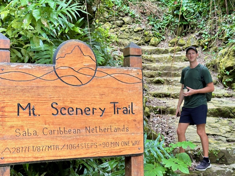
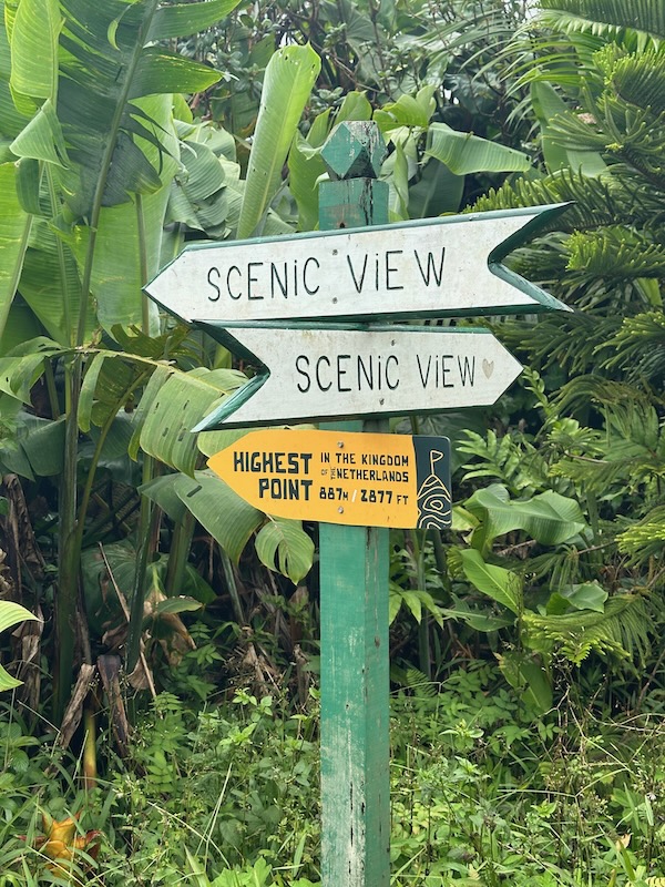
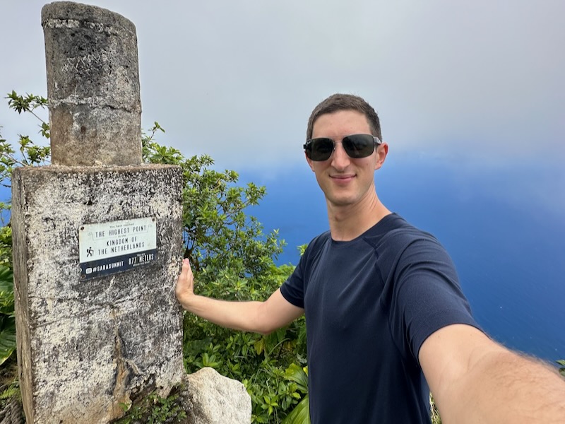
- Elevation: 877 m / 2,877 ft (Tallest Mountain in the Netherlands)
- Trail Distance: ~2.1 km (~1.3 miles one way)
- Average Hiking Time: 60–90 minutes to the summit
- Trail Type: Out & back, mostly stone steps
- Starting Point: Windwardside, Saba
- Difficulty: Moderate (steep incline, many stairs)
- Best For: Nature lovers, cloud forest explorers, Caribbean hikers
- Pro Tip: Go early and aim for a clear day — visibility at the summit can change fast!
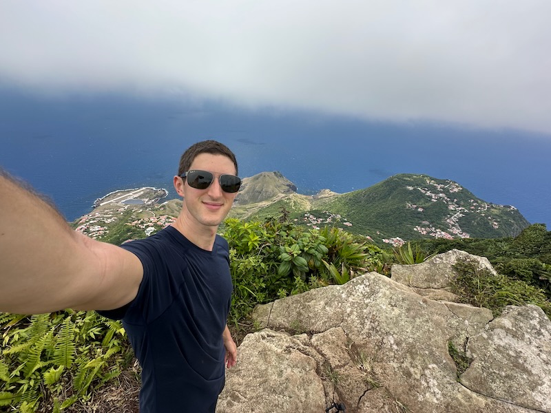
The Mount Scenery hike is the most iconic trail on Saba Island — and for good reason. At 877 meters (2,877 ft), it’s the tallest point in the Kingdom of the Netherlands, winding through a rare Caribbean cloud forest to panoramic viewpoints.
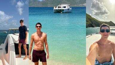
I hiked it twice during my week on the island — once in full cloud cover and once under clear skies. Each time was unforgettable. Whether you’re chasing summit views or just want to wander through moss-covered jungle, this guide covers everything you need to know before hiking Mount Scenery.
Find where to stay in Saba at the best hotels and villas on Expedia!
Mount Scenery Trail Overview
Where the Mount Scenery Trail Starts (Windwardside Trailhead)
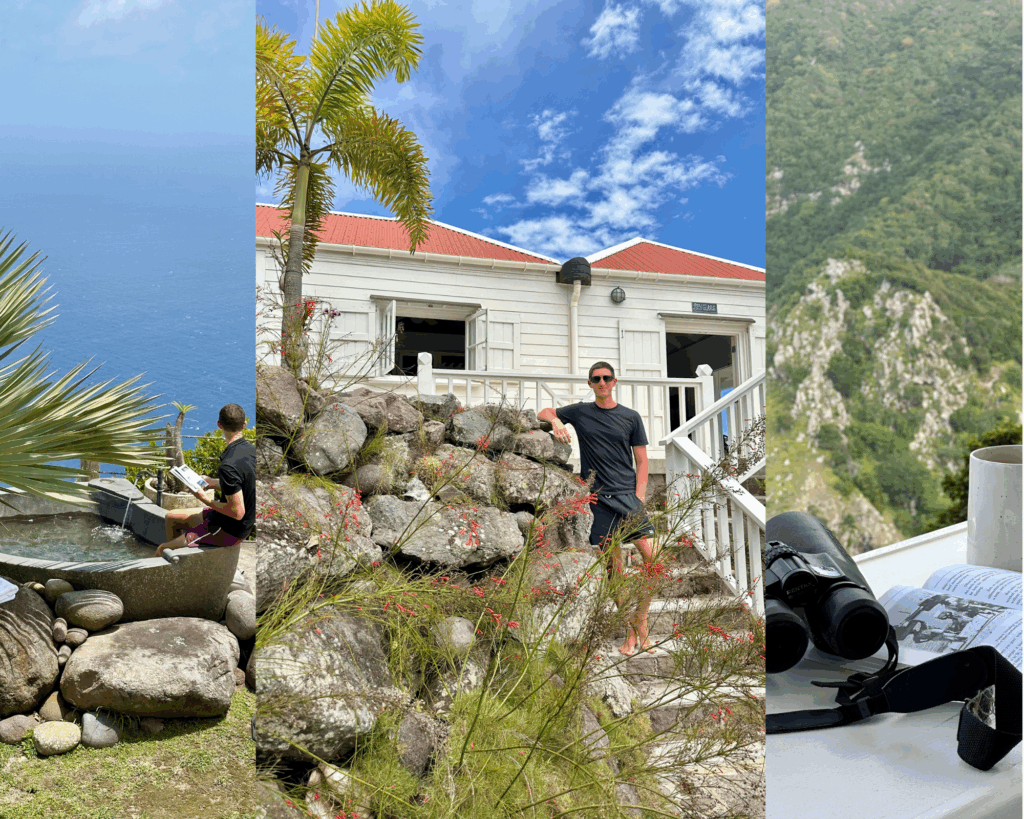
The Mount Scenery trail starts just outside the town of Windwardside, Saba’s most walkable and traveler-friendly village. From the center of town, it’s about a 5–10 minute walk to the trailhead, which is clearly marked and easy to find. If you’re staying in Windwardside — and I recommend you do — you can walk straight to the trail, no transport needed. I hiked right from Spyglass Villa, which made it super convenient to monitor the weather and jump on the trail when conditions looked good.
You’ll find the official trailhead sign next to a small set of concrete stairs and a covered rest area — a good place to stretch before starting your ascent.
Trail Distance, Elevation & Difficulty
- Distance: ~2.1 km (~1.3 miles one way)
- Elevation Gain: ~600 m (1,970 ft)
- Time: 60–90 minutes up, ~45 minutes down
- Difficulty: Moderate — mostly due to the endless stairs and constant incline
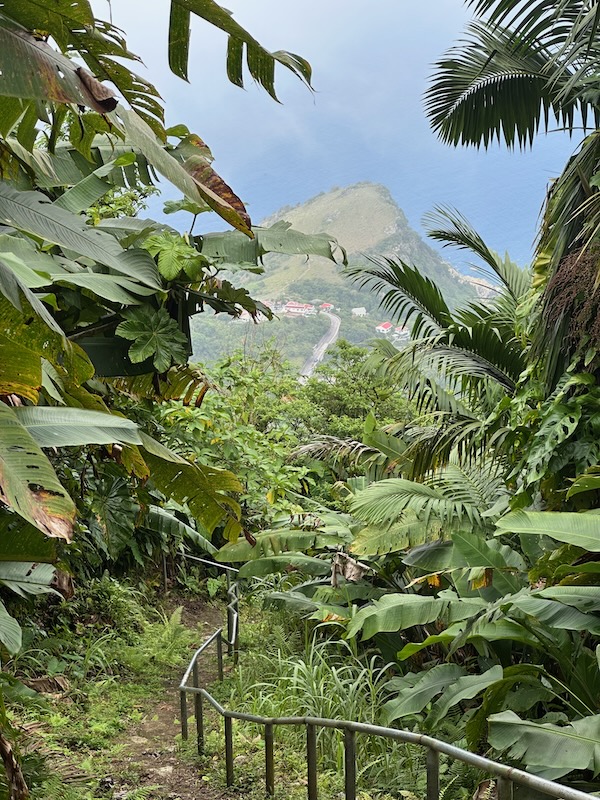
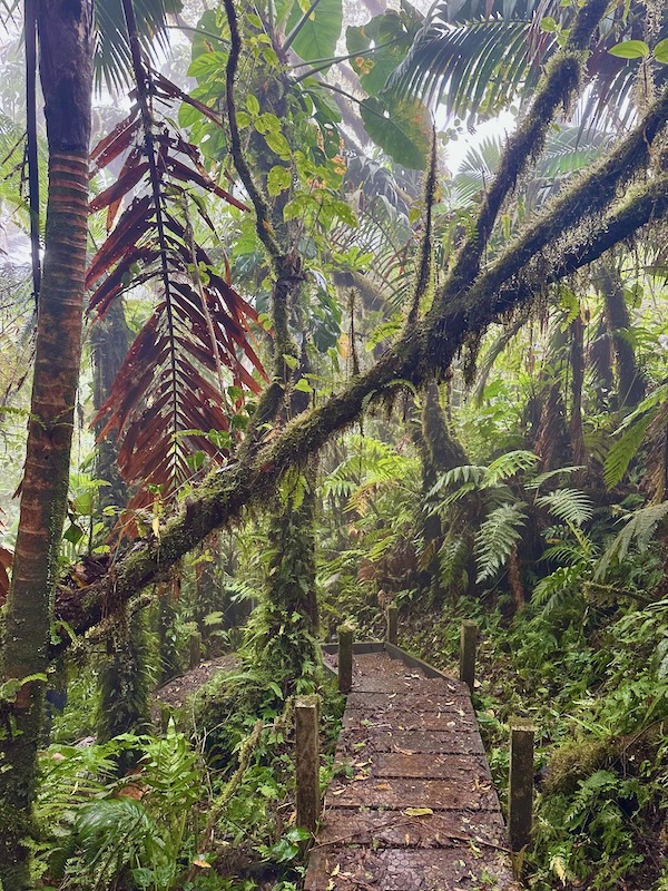
This is not a flat hike — you’re climbing pretty much the entire way up. The path is made up of roughly 1,064 stone steps, which can be slick and muddy depending on the weather. The good news? It’s well-maintained, clearly marked, and doesn’t require any scrambling. Just bring stamina and good shoes.
What Makes This Trail Unique in the Caribbean
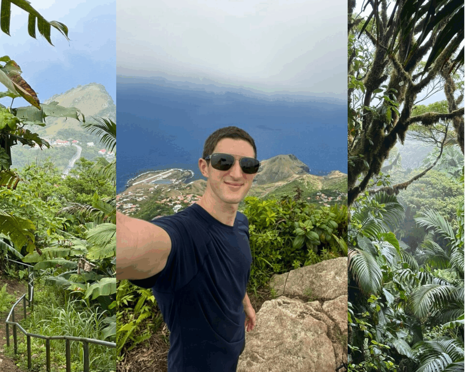
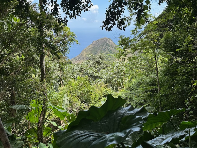
While most people think of the Caribbean as all sun and sand, Saba flips that script. There are no beaches here, but what it offers instead is a dense, misty cloud forest ecosystem — something rare for the region. Hiking Mount Scenery takes you through shifting environments, from tropical greenery to jungle-thick moss and fog at the top.
It’s one of the few places in the Caribbean where you can walk through a mountain rainforest and be completely surrounded by silence, birdsong, and soft mist. It’s not just a hike — it feels like stepping into another world.
What to Expect on the Mount Scenery Hike in Saba
Terrain, Weather & Trail Conditions
Expect mud, stairs, and sweat — but also a trail that’s incredibly well-marked and maintained. The majority of the path is made of stone steps, winding through dense vegetation and gradually getting wetter and cooler the higher you go. There are no flat sections to speak of — it’s a steady climb from the first step to the last.
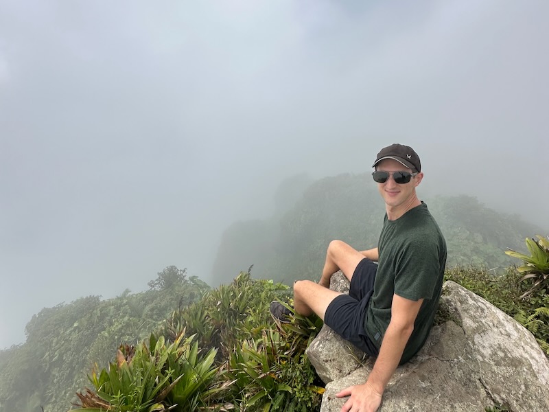
Weather on Saba changes fast, especially around Mount Scenery. The summit is often covered in cloud, which is part of its charm — but it also means visibility can be hit or miss. I spent three days waiting for the clouds to lift before my second attempt, and it was worth it. If you spot a clear day, go for it early — the weather often closes in again by midday.
Wildlife and Flora Along the Way (Cloud Forest Saba)
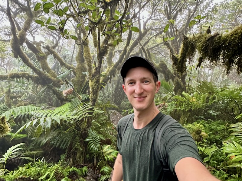
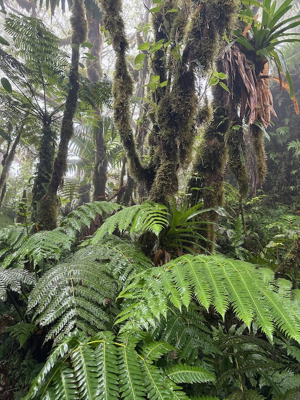
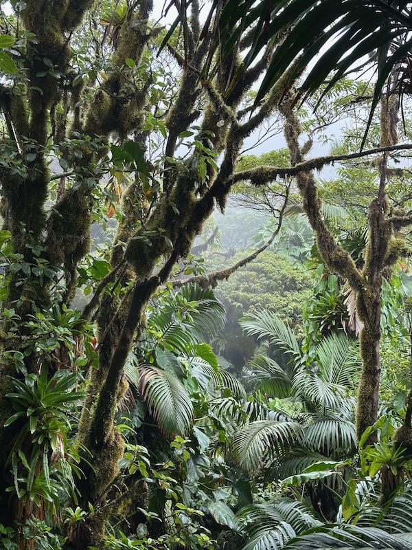
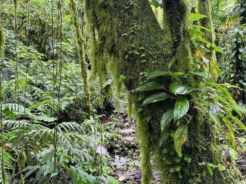
One of the biggest highlights of the hike is the incredible biodiversity. You’ll pass plants with giant, prehistoric-looking leaves, tropical flowers, ferns, and vines. Near the top, you’ll enter Saba’s unique cloud forest, where every surface is covered in moss, mist, and moisture.
It’s a haven for birdlife too — keep an eye (and ear) out for the Saba Bananaquit, hummingbirds, and if you’re lucky, the elusive Saba Parrot. The deeper into the forest you go, the more it feels like stepping into something out of a fantasy novel.
Navigating the Trail Markers and Signage
Saba’s hiking network is one of the best-marked trail systems in the Caribbean. You’ll see color-coded signs and arrows throughout the Mount Scenery trail, and every major junction is clearly labeled. Around 15–20 minutes into the hike, you’ll come across a fork to the Mas Cahones Trail, which is worth the detour for a stunning overlook of Windwardside.
Later on, you’ll see signs pointing toward Crispeen Trail, Elfin Forest, and The Bottom Mountain Trail — all part of Saba’s interconnected network. It’s hard to get lost, but having AllTrails or Google Maps offline downloaded never hurts.
Exploring the Saba Cloud Forest
What Is the Saba Cloud Forest?
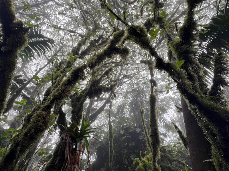
A cloud forest is a high-altitude tropical forest where constant moisture from cloud cover creates a unique, misty ecosystem. Think dense vegetation, moss-covered trees, dripping branches, and a permanent sense of twilight. These forests are incredibly rare in the Caribbean — and Mount Scenery’s cloud forest is one of the most accessible and impressive you’ll find anywhere.
It’s often the part of the hike that surprises people most — and for me, it was the highlight.
Unique Ecosystem of Mount Scenery
The cloud forest sits near the summit of Mount Scenery, and the transition into it is almost instant — one minute you’re surrounded by tropical greenery, the next you’re in a foggy, still world of ferns and moss. This ecosystem exists thanks to Saba’s altitude and consistent trade winds, which trap moisture around the peak year-round.
You’ll walk under canopies of Mountain Mahogany, pass thick trunks coated in green, and spot tiny epiphytic plantsgrowing out of the bark. It’s a botanist’s dream — or just pure magic for any nature lover.
Plants, Mosses & Mist: What You’ll See on the Trail
The entire trail is lush, but once you enter the cloud forest, it becomes something else entirely. You’re surrounded by:
- Spongy moss covering tree trunks and rocks
- Dripping vines and ferns suspended in mist
- Leaf litter and rich, damp earth underfoot
- Constant humidity that makes the air feel thick, quiet, and still
There’s very little direct sunlight — just the occasional shaft of light breaking through. On both of my hikes, I found myself slowing down here, just to take it all in. It’s one of those places where time sort of stops.
Interconnected Hikes from Mount Scenery Trail
One of the best things about hiking on Saba is how connected everything is. The Mount Scenery trail isn’t a standalone hike — it links into a larger network of well-marked trails that crisscross the island. If you’re looking to explore beyond the summit, here are three interconnected hikes worth checking out:
Mas Cahones Trail
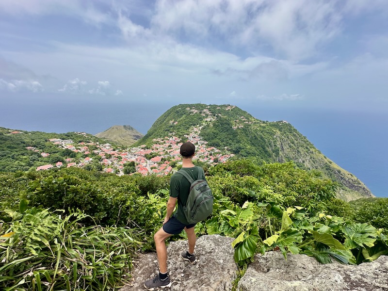
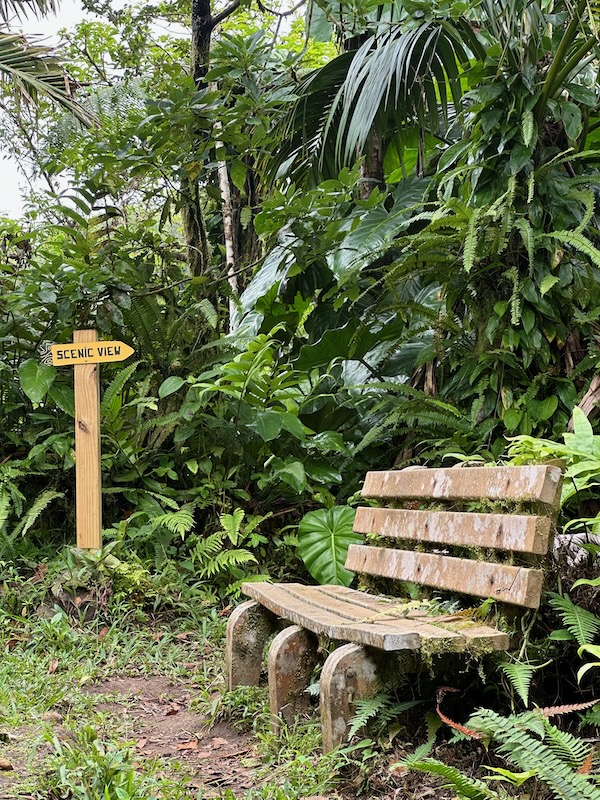
Roughly 15–20 minutes into the Mount Scenery hike, you’ll reach a signposted junction for the Mas Cahones Trail — and you should absolutely take it. It’s a short detour with stunning views of Windwardside, the surrounding hills, and on a clear day, even the ocean beyond. It’s one of the best viewpoints below the cloud line, which makes it a perfect Plan B if the summit is fogged in.
- Distance: ~0.8 km out-and-back
- Difficulty: Easy to moderate
- Best For: Clear, unobstructed views — great photo spot
- Pro Tip: Hit this one early in the day before the clouds roll in
It’s also a good place to stop for a water break and appreciate just how high you’re climbing — the perspective over Windwardside really shows the elevation gain.
Crispeen Track
About halfway up the Mount Scenery trail, you’ll hit the junction for the Crispeen Track, which heads down toward The Bottom and passes through more open, less forested terrain. If you’re feeling adventurous, this is a great option to create a loop back to town via a different route.
- Distance: ~2.2 km from junction to The Bottom
- Trail Conditions: Narrow in places, with steeper gradients
- Highlights: Southern views, solitude, and more dry forest vegetation
Elfin Forest Trail
Branching off near the summit, the Elfin Forest Trail is perfect for anyone who can’t get enough of the cloud forest vibes. It loops through some of the densest moss-covered terrain on Saba, with gnarled trees and misty stillness that feel straight out of a storybook.
- Distance: ~0.5 km loop
- Best For: Immersive cloud forest experience
- Tip: Trail can be muddy — wear shoes with traction
Bud’s Mountain Trail
For a longer route, you can connect with Bud’s Mountain Trail, which curves around the southern base of Mount Scenery and back toward Windwardside or Upper Hell’s Gate. This one’s less frequented and a bit wilder, making it a good choice for experienced hikers or those staying longer on the island.
- Distance: Varies — ~4–5 km depending on entry/exit
- Difficulty: Moderate to challenging (mud + incline)
- Highlight: Expansive forest sections and true off-the-beaten-path feel
These trails all link back into the Saba Trail Network, which is one of the most impressive in the Caribbean. If you’re staying more than a couple of days on the island, I highly recommend picking a few of these to combine with your Mount Scenery hike — especially if you’re lucky enough to get a clear day.
Tips for Hiking Mount Scenery in Saba
Whether it’s your first time hiking in the Caribbean or you’re a seasoned trail lover, here are my best tips for making the most of your Mount Scenery hike:
- Start early in the morning — The summit is often clearest right after sunrise. Clouds tend to roll in by late morning or midday.
- Keep an eye on the peak — If you’re staying in Windwardside, you can often see the summit from town. If it’s visible, that’s your window to go!
- Bring more water than you think you need — The trail is short, but the incline and humidity will have you sweating nonstop.
- Wear proper shoes — No flip-flops or flat sneakers. It’s muddy, slippery, and steep. Trail runners or hiking shoes with traction are best.
- Expect to get muddy — The trail stays wet and slick due to the constant moisture. Embrace the mess — it’s part of the adventure.
- Download offline maps — Trails are well-marked, but I still recommend having AllTrails or Google Maps offline, just in case.
- Pack a snack or light lunch — Especially if you’re planning to sit at the summit or continue onto side trails like Bud’s or Crispeen.
- Use a walking stick or trekking poles — They’re helpful on the muddy, uneven steps, especially for the descent.
- Don’t rush the cloud forest — This is the most magical part of the hike. Slow down, listen to the birds, and take it in.
- Be patient with the views — Even if the summit is cloudy, hang around — sometimes it clears for just a few minutes and you’ll get rewarded.
- Respect the trail — Stay on the path, don’t damage vegetation, and pack out all your trash. This is a protected ecosystem.
- Yes, it’s safe for solo hikers — The trail is well-used and clear, and Saba is one of the safest islands in the region. Just use normal hiking precautions.
Best Places to Stay in Windwardside for Hiking Mount Scenery
If you’re planning to hike Mount Scenery (and you should), Windwardside is hands-down the best place to stay. It’s walkable, close to the trailhead, and full of charm — think colorful cottages, friendly locals, and wraparound views of the mountains and sea.
Why Windwardside is the Ideal Base for Hikers
- The trailhead is right in town — no transport needed
- You can see the peak from your balcony and watch for clear skies
- Lots of restaurants, markets, and services within walking distance
- It’s the most hiker-friendly village on Saba with access to multiple trails
I stayed in Windwardside for a week and wouldn’t have done it any other way. I could literally roll out of bed, check the weather at the summit, and hit the trail in under 10 minutes.
Recommended Lodging Options Near the Mount Scenery Trailhead
Spyglass Villa (My Pick)
This is where I stayed during my week on Saba, and it was perfect. Spyglass Villa sits just above Windwardside with sweeping views of Mount Scenery and the Caribbean. I could literally check the summit for clouds from the patio, which made timing my hikes so much easier. It’s quiet, private, and a great place to relax after muddy trail days. Ideal for digital nomads or couples who want space and scenery.
Learn more about Spyglass Villa with my full review!
The House on the Path (Off-the-Grid Jungle Stay)
This cottage is located on the Mount Scenery trail itself — seriously, the only way to get there is to hike in. It’s rustic, peaceful, and feels like something out of a jungle fairytale. There’s no hot water, no air conditioning, and the management could use a little polish, so I only recommend it if you’re okay with the quirks. But if you want to live in the cloud forest, this is as close as it gets.
The Cottage Club Hotel – Quirky and charming with rustic Caribbean cottages set around a hillside garden. There’s a small pool, and many cottages have balconies with views of the sea. A great mid-range option just a short walk from shops and restaurants.
Juliana’s Hotel (Best Budget Option)
Juliana’s is a Windwardside classic — affordable, laid-back, and well-located. It’s just a short walk to the trailhead and has a good on-site restaurant (Tropics Café) for your pre- or post-hike meals. The rooms are simple but comfortable, and it’s a solid choice if you want something reliable without spending too much.
Learn more about where to stay in Saba with this guide!
Conclusion: Is the Mount Scenery Hike worth it?
If you can only do one hike on Saba, make it Mount Scenery. Whether you hit the summit on a clear day or wander through the mist of the cloud forest, the experience is unforgettable. It’s challenging without being extreme, incredibly scenic, and uniquely Saba — no beaches, no crowds, just rainforest, stairs, and solitude.
I did the Mount Scenery hike twice, and I’d gladly do it again. Plan to get muddy, sweat through your shirt, and maybe even sit in a cloud — but that’s the magic of this trail. Base yourself in Windwardside, start early, and don’t forget to check out the interconnected trails like Mas Cahones or Elfin Forest while you’re at it.
For more slow travel tips and hiking guides from Saba and beyond, check out my full Saba travel section.
F.A.Q.’s Mount Scenery Saba Hiking Trail
How hard is the Saba Mount Scenery hike?
It’s a moderate hike, mostly due to the constant uphill and more than 1,000 stone steps. It’s not technical, but you’ll definitely feel the burn.
What’s the best time to hike Mount Scenery?
Early morning, ideally after a clear night. Cloud cover often builds by late morning, so get started as soon as possible. But it can also clear up in the afternoon so it all depends.
How long does it take to hike Mount Scenery?
Most hikers take 60–90 minutes to reach the summit, and about 40–50 minutes to descend, depending on conditions.
Is Mount Scenery the tallest mountain in the Netherlands?
Yes — at 877 meters (2,877 ft), Mount Scenery is the highest point in the entire Kingdom of the Netherlands.
Can you hike Mount Scenery without a guide?
Absolutely. The trail is clearly marked and easy to follow. No guide needed unless you want extra context on flora, fauna, or geology.
What should I wear to hike Mount Scenery?
Wear grippy shoes (no flip-flops!), bring plenty of water, and be ready for mud. A light rain jacket or poncho isn’t a bad idea either.
Is the trail safe for solo hikers or beginners?
Yes — the trail is safe and frequently used. As always, let someone know your plans, but this is one of the safest solo hikes in the Caribbean.
What kind of forest is at the top of Mount Scenery?
It’s a cloud forest, a rare high-elevation rainforest filled with moss, mist, and dripping vegetation. It’s the highlight of the hike for many (myself included).
Will I see any wildlife on the trail?
Yes — especially birds like the Bananaquit, hummingbirds, and other forest species. Keep an ear out for bird calls in the cloud forest section.